
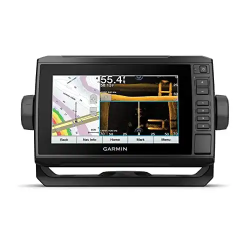
Find more fish using the ECHOMAP™ UHD 73sv combo with a bright, sunlight-readable 7” touchscreen with keyed assist. Preloaded LakeVü g3 inland maps with integrated Navionics® data cover more than 17,000 lakes with up to 1’ contours.
It was the dream of anglers since man first dropped a line in the water. The idea of knowing what lies beneath the surface was enticing enough, being able to find an exact location every time you ventured back on the water was beyond anyone’s wildest imagination.
Imagination, and those old dreams, met the advance of technology with the world’s foremost personal sonar company in Garmin.
This Garmin Echomap 73sv review brings all those ideas to one easy-to-use device. A fish finder small enough to mount on almost any size boat.
Garmin Echomap UHD 73sv Fish Finder — Merging Technologies
The Garmin Echomap 73sv is an incredible fish finder that merges the two most popular personal sonar technologies into one easy-to-use package.
There are two types of imaging available in a sonar-based fish finder and underwater topographic mapping technologies. One shoots a sonar data signal straight down below a boat, mapping the contours and locating underwater objects as the vessel passes overhead. This is commonly called down imaging. The other uses a sonar data signal to map both sides of a boat as it passes and is commonly known as side imaging. Combine, the two, and you have a technique of viewing, and mapping, the underwater structure second to none with this fish finder.
Before we delve into what makes this such a great fish finder for anglers, let’s take a look at the technology packed into this compact design.
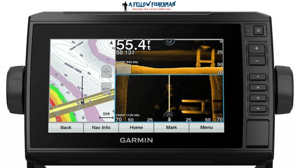
The first thing to consider with fish finders is the display you’ll be watching on your boat. The Garmin ECHOMAP UHD 73sv fish finder has an ample seven-inch WVGA display with a 480×800 pixel resolution. What you’re going to be viewing on that screen is the second-biggest consideration.
The 73sv fish finder offers both side and down imaging in a two-dimensional format. You won’t miss many underwater structures when viewing imaging on these fish finders.
These fish finders offer a compatible transom mount, or you can mount the transducer directly on your trolling motor.
With 500 RMS watts or 4,000 watts peak to peak, you’ll have the transmitting power to reach deep into the depths of the largest inland lakes or even offshore on the ocean.
Three sonar frequencies enhance your viewing capability well beyond the level of the competition in the same price range.
The traditional CHIRP sonar data works at 50/77 and 200 kHz, while the ClearVU sonar (down imagining) and SideVu sonar (side imaging) have frequencies of 260/455 and 800 kHz.
Frequencies probably don’t mean much to the average user; what does mean a lot is the depths you can reach with these frequencies in play on your fishfinder.
The Garmin ECHOMAP UHD 73sv with CHIRP sonar technology can reach maximum depths of 2,300 feet (0.7 km) at 77 kHz in freshwater, and roughly half that depth, 1,100 feet (0.34 km) at 77 kHz in saltwater.
That’s a lot of range for a compact fish finder like the Garmin ECHOMAP UHD 73sv.
Viewing fish symbols in real-time is fun, interesting, and can be exciting if you spot a school of fish you’re after. The real power of this device is its ability to accurately map and store information by integrating built-in GPS technology into these fish finders.
The Garmin ECHOMAP UHD 73sv has an internal GPS antenna and is capable of storing 5,000 waypoints. It can record up to 100 routes for tracing your current adventure back to the identical location in the future, and it can save 50,000 point plots and 50 saved tracks.
Creating your own maps is exciting and a boon to professional fishing guides and charter boat captains, as well as commercial fishermen. It can be your little secret as a recreational angler to locate and return to your favorite fishing spot each time you back your trailer into a lake for a day’s adventure on the water.
Garmin offers a wide range of preloaded maps as well in its LakeVu HD software package.
These Garmin fish finders integrate seamlessly with the Fusion link audio system and the Active Captain app. For complete wireless connectivity, choose Garmin devices for all of your marine electronics onboard.
CHIRP Sonar(Hint, it’s not the sound a bird makes)
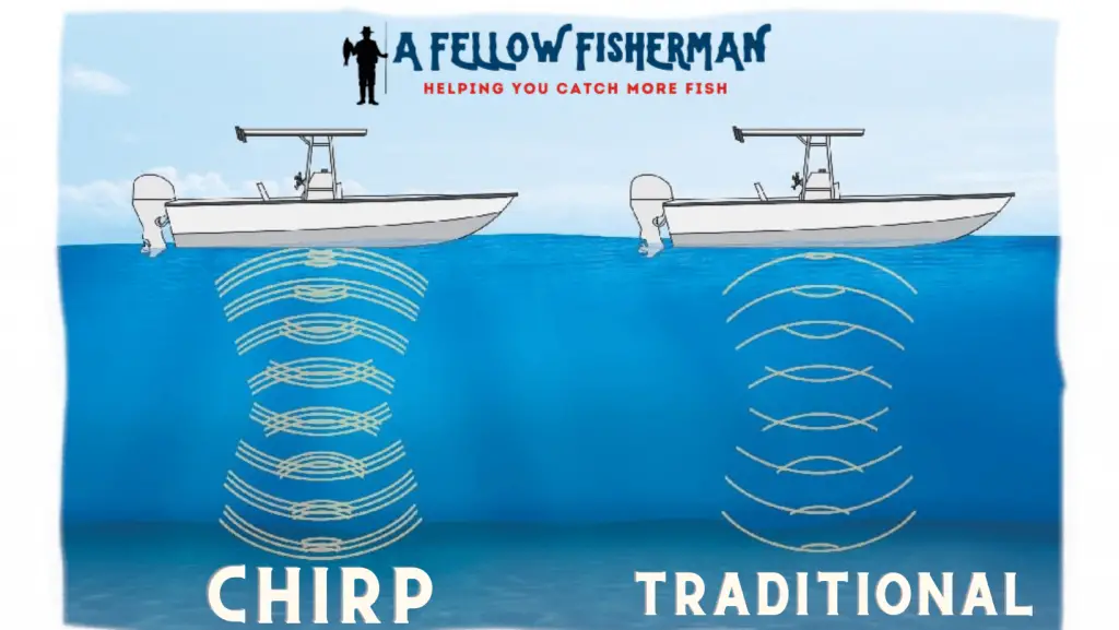
Compressed High-Intensity Radiated Pulse (CHIRP) is an advanced technology that utilizes a continuous sweep of sonar frequencies in low to high range format. The result of this missing sonar beyond one frequency is that it proves much more detailed information when the sound pulses return to the Garmin ECHOMAP UHD 73sv.
Garmin fish finders with CHIRP sonar work in conjunction with Garmin’s proprietary LakeVu software. Load the LakeVu into your fish finder with a standard Micro SD card, and you’ve got detailed underwater maps of 17,000 lakes, reservoirs, and rivers in the United States. If that’s not enough, you can always create and store your own maps on the same SD card.
The LakeVu software offers detailed maps from shallow water to the maximum depth of these fish finders at 2,300 feet (0.7 km).
The software had detailed maps of 13,000 freshwater lakes with 12 inch (0.3 m) contours but goes beyond the hidden underwater features to include road maps indicating local roads, state highways, federal highways, and neighboring interstate highways. Docks, bridges, campgrounds, and marinas, along with designated public fishing areas, are all easy to find with this software.
It takes the guessing out of getting there for the weekend angler trying to locate a new spot on the water.
Mapping Your Path
Maps and underwater images are incredible weapons in an angler’s arsenal. The Garmin ECHOMAP UHD 73sv fish finders offer another amazing technology in its ability to clearly define the shortest route to a destination and display it clearly on the seven-inch screen.
When used with BlueChart g2 Vision map software and Garmin Auto Guidance, you can access the shortest path maps that clearly mark the best route to a fishing spot. You can select the shortest path option, but the software is so sophisticated that it will create paths based on your boat’s specifications. What that means to you is that you can avoid shallow water, underwater obstacles, or dangerous rocks while still following the shortest, safest route to your destination on the lake, river, or oceanfront.
Software Options
Pantoptix Live Forward Sonar technology is available using the Pantoptix sonar port and a corresponding transducer. It doesn’t matter if you’re sitting still in the water or trolling forward; you’ll see live images of what’s going on under the surface up to 100 feet (30.48 m) away from your boat.
The imagery with these fish finders is so clear you can watch fish swim by or watch them as they strike your bait. You can even watch the battle underwater as you reel in a hard-fighting fish from the depths.
For software updates, visit Garmin Home Port, where they make it easy to update all of your Garmin devices.
The Shortest, Safest Path
Here is a little more information on just how amazing the results are when you mix high-level GPS with the mapping software available for the Garmin ECHOMAP UHD 73sv fish finders.
Many lakes are crossed by causeways with low, narrow openings or by low bridges. In the days before advanced technology, it was up to the boat operator to guess if the highest point of the craft would clear the lowest point of the bridge or causeway.
Using Garmin’s patented Auto Guidance system takes that guesswork out of the equation. The software will plot a route that avoids low bridges, shallow water, or areas closed off by state or local parks and recreation departments.
Set the target, engage the autopilot and follow the path to your next fishing destination. All this information can be stored on that tiny Micro SD card for future trips.
Making Your Own Maps
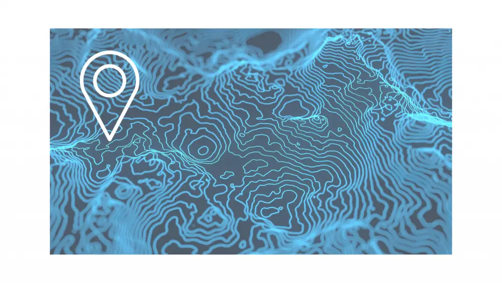
The free Quickdraw Contours software included with your Garmin ECHOMAP UHD 73sv is a full-featured, easy-to-use mapping software package that lets you create detailed maps down to 12-inch contours on lakes of your choice. Garmin offers detailed maps of 17,000 major rivers, lakes, reservoirs, and coastlines, but there are literally hundreds of thousands of lakes in the United States you can navigate with a boat.
Creating maps of these local hot spots isn’t difficult with the Quickdraw Contours software.
As is often misspoken, “It’s not rocket surgery.”
You don’t have to have any special cartographic skills or be an IT professional to use this software. All you have to do is fish. The Quickdraw Contours software records your path, maps the underlying structure, and creates detailed maps for you to store. Turn the software on, then turn it off when you’re finished. The Quickdraw Contours does all the work, then stores it on the fish finder.
The best part is that this is your personal map; you own it. You can keep it for yourself, or you can join a growing community of Garmin users and upload these maps to a website, so other anglers can use the map you created.
The Quickdraw Contour works with all Garmin fish finders and with any Garmin Pantoptix, HD-ID, or CHIRP sonar-enabled fish finders. The software will integrate with compatible marine electronics on your boat and upload the maps to the screen.
A final benefit of the Quickdraw Contour mapping software is the ability to color-code up to 10 different depths. This makes following underwater benches, outcroppings, and drop-offs much easier to see on the screen. The same color depths create an image that jumps out to you on the screen, making your next location an easier choice, especially if you’ve discovered schools of fish hovering at a specific depth.
Garmin Echomap 73sv Review Conclusion
Fishing is just about the most fun you can have in the great outdoors, it can be one of the most frustrating outdoor experiences as well if you don’t catch any fish.
Locating the fish is the hard part of any fishing trip.
As they say in real estate, location, location, location. The same is true when it comes to finding trout, walleye, redfish, largemouth bass, catfish, perch, crappie, or any other fish species.
Find the fish, find a bait they’ll hit, and let the fun begin.
A Garmin ECHOMAP UHD 73sv can significantly increase your chances of finding fish. It can also offer you a safe path devoid of underwater obstacles in pursuing those fish.
For a moderate price, it’s a fish finder that pays for itself many times over.
That’s all for our Garmin Echomap UHD 73sv review. Click below to find it on Amazon.
For more guidance on many other fish finders, check out the pages below:
